Caspar Dechmann
Cornwall And West Devon Mining Landscape
Cornwall and West Devon Mining Landscape (Inscribed)

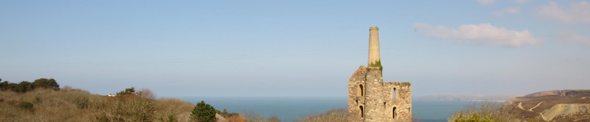
This site is hard to grasp since it is so wide spread, perhaps too wide. When I was traveling SW England this summer I wanted to see a representable part of it and decided to visit the two nearest areas: The Tamar Valley and the Cartoon Mining District. The Tamar Valley has a lot to offer: The lively town of Tavistock has evolved architectonically nicely from medival origin to its peak time in the 19th century. It has a impressive church where as often in England friendly elderly people drank and offered tea! You can walk along the quite natural river Tavi and parallel along the historically important straight Tavistock Canal. Have also a short look at the neogothic Mount Kelly College and if you like English cemeteries (as I do) there is a beautiful one right south of Dolvin Road. I can recommend the B&B The Cornish Arms, also for great Dinner and Breakfast. The nearby Tamar Valley is a lovely lush river valley, taken back by nature. There is a the interesting and historically important industrial site of Morwellam Quay. Also in this area are the Calstock Aqueduct and the estate of Cotehele: This is the mansion of a family that was closely linked with the industrialization of the area and includes an old mill and an industrial site at the river. I felt that this combination of nearby sites gave me quite a good overview of this WHS but I wanted to see at least one of the iconic engine houses. Since the brilliantly situated engine houses in St. Agatha were quite fare we drove to the Minions, about half an hour further west. This is a good starting point for walks in all directions. We left the car at the minions shop and decided to walk NNW and it turned out to be a wonderful walk: You walk through a almost Scottish moor landscape with lots of fern, wind shaped trees, sheep and cattle (and lots of droppings everywhere!). You pass two ancient stone circles (Hurlers stone circles, a first for me) and get further north to an old quarry and to the strange, supposedly natural stone heaps called the Cheeswring. From there you can walk SE to the quite impressive ruins of the South Phoenix Mine, from there SW to the Minions heritage center and our starting point. I can only recommend this walk but I recommend to take a GPS and a internet map along. There are absolutely no signs at all and after the Cheesewring it is often a bit adventurous to find the path. The map we bought at the Minions shop was of little or no use. It is better to find the places on Google map before you go, to bring good shoes and enough time.
Comments
No comments yet.