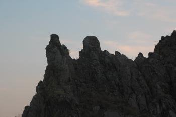
Though it is called in the touristic brochures "The Stonehenge of the Balkans", Kokino is definitely far less spectacular. But if you happen to visit Macedonia, or on the way form Central Europe to Greece - as we did - it is an easy and pleasant detour. There are quite a few publication that describe how was it built (or used), and place Kokino among the paleo-astronomical observatories of the world. I am not an expert ob it, so I rather omit theis part. if you are interested, you can read it here, or here. Anyway, it is quite useful, if you make a reasearch before, and print out one of these articles as on the site you will find no clue what is what, and what should you find, or seek. So, as for the scientific side you can be prepared, but if you would like to know the practiclaities, you jump in one of the black holes of the net. Event on the site that looks like an official site of the place, if you open the "How to get there" section you get a detailed list of the airlines that serve Skopje, but nothing closer. Other sites it is write, that it is "near Staro nagorichane", without any exact defitnition of being "near". it is not clear either how steep is the slope leading to the observatory, whether it can be done without special hiking experteese. So here it is:
If you do not have your own vehicule getting to Kokino can be a big chellenge. You may rent a taxi in Kumanovo - or even in Skopje - if your bargaining skills are good. This will prevent you from getting lost in the Balkans. As Kokino is in the middle of nowhere no public transport goes there. Driving from Skopje you have to follow first the Beograd / Kumanovo signs (E75). Before reaching Kmanovo itself, there will be an intersection where you have to turn right, in the direction of Kriva Palanka (Bulgaria) E71. In some kilometers you will see the sign on the left side Staro Nagorichane. (All singboards are bilingual, so you do not have to read Cyrillic letters.) Here is the first KOKINO signboard too. From there Kokino itself is cca 15 km - definitely not in walking distance from Staro Nagorichane. . You can trust the sings, if you have to turn somewhere, there will be a singboard, but drive carefully and slowly, do nott miss them. At intersections where you do not have to turn, just follow the road there are no signs. Though the road leads you through shabby poor villages, it is quite in a good condition, probably built and financed by some aid agencies, in order to make Kokino a tourist attraction. It is not, there are no kiosks, no food stalls or whatever. At a point the road will be very narrow, barely enough even for one car, but as there is practically no traffic it is ok. Trust the sings from there, not the satellite navigation - the road is rather new, and missing from some softwares. You will see the hill, and the observatory on its peak form a distance. The road sneaks up the hill - and this is the only paved road there, so if you do not leave the paved road you are on the good track.
Near the peak you will find a singboard - KOKINO, with some information on its back. If you do not have some detailed description printed out, read it, and try to memorize, up in the peak there will be no isgns, no descriptions. Be careful! There are two paths leading from the parking lot. One looks much better, rather like an unpaved road. The other is much less pretty, and steeper. This is deceipting! You have to choose the worse path, that goes directly uphill. In 15-20 minutes you can reach the rocks. Upto tihs part, it is walkable even for those who are physically not that fit. From there the path diappears, and you have to climb the bare rocks. No stairs, no causeways, nothing, just the rock. Adventurous it is, but definitely not safe for those who are physically chellenged.
The landscape is astonishing, and, if you have a good description, a map and even better imagination you will find the "Shamans throne" and other alndmarks.
Comments
No comments yet.
